

by Mid-Ohio Regional Planning Commision, 2016
http://apps.morpc.org/bikemap/
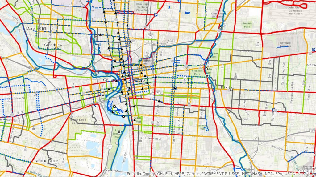
The Columbus Metro Bike Map was created in 2016 with input from the bicycling community to help cyclists determine which roads may be best suited for their level of riding in the Greater Franklin County area. The roads are color-coded for non-rush hour travel with green as “Good”, orange as “Moderate”, and red as “Poor”.
Visit our Bicycle & Pedestrian page for more information and to learn how to obtain a printed map.
For info on the On-Road Facilities layer click here.
For info on the Multi-Use Path layer click here.
For info on the Trailheads layer click here.
For info on the Level of Comfort layer click here.
For info on the Points of Interest layer click here.
For info on the Greenways layer click here.
This is a great resource for any cyclist who rides in the Greater Columbus area. This is important for planning new infrastructure and helping keep people safe when using the roads. Any major city should provide easy access to a map similar to this.


